caes

Parc del Castell de Montesquiu

Navegació

Situació i accessos


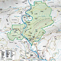
Situat a cavall de les comarques d'Osona i del Ripollès, entre els termes municipals de Montesquiu, Sant Quirze de Besora, Santa Maria de Besora i Sora, el parc té una superfície, relativament modesta, de 547 ha, en gran part en el terme de Montesquiu. El seu territori es troba dividit en dues parts pel curs del riu Ter, força més gran a la riba esquerra i més petita i amb un relleu més suau a la riba dreta.

Carreteres:
C-17 Barcelona-Vic-Puigcerdà (antiga N-152)


S'ha produït un error mentre es processava la plantilla.
The following has evaluated to null or missing:
==> marca.iconaMarcador.urlExterna2  [in template "10311#10344#MAPA_GOOGLE" at line 24, column 39]

----
Tip: It's the step after the last dot that caused this error, not those before it.
----
Tip: If the failing expression is known to legally refer to something that's sometimes null or missing, either specify a default value like myOptionalVar!myDefault, or use <#if myOptionalVar??>when-present<#else>when-missing</#if>. (These only cover the last step of the expression; to cover the whole expression, use parenthesis: (myOptionalVar.foo)!myDefault, (myOptionalVar.foo)??
----

----
FTL stack trace ("~" means nesting-related):
	- Failed at: #assign iconaMarcadorURL = marca.icon...  [in template "10311#10344#MAPA_GOOGLE" at line 24, column 12]
----
1<link rel="stylesheet" href="https://unpkg.com/leaflet@1.9.1/dist/leaflet.css" integrity="sha256-sA+zWATbFveLLNqWO2gtiw3HL/lh1giY/Inf1BJ0z14=" crossorigin="" /> 
2<script src="https://unpkg.com/leaflet@1.9.1/dist/leaflet.js" integrity="sha256-NDI0K41gVbWqfkkaHj15IzU7PtMoelkzyKp8TOaFQ3s=" crossorigin=""></script> 
3 
4<div id="map${.vars["reserved-article-id"].data}" class="embed-responsive embed-responsive-16by9" style="clear:both;margin:10px 0"></div>  
5<#assign apostrofe="'">  
6<#assign replaceApostrofe="\'">  
7<#assign intro="\n">  
8<#assign replaceIntro="">  
9  
10<script>   
11var map${.vars["reserved-article-id"].data} ;  
12<#assign i=0>  
13var markers = [  
14<#assign iconaURL= icona.getData()>  
15<#if icona.urlExterna?? && (!iconaURL?has_content ||  iconaURL?length ==0)>  
16   <#assign iconaURL= icona.urlExterna.getData()>  
17</#if>   
18<#list marcador.getSiblings() as marca>  
19    <#if i gt 0>  
20		,  
21	</#if>  
22	<#assign iconaMarcadorURL= marca.iconaMarcador.getData()>  
23	<#if !iconaMarcadorURL?has_content ||  iconaMarcadorURL?length ==0>  
24	   <#assign iconaMarcadorURL= marca.iconaMarcador.urlExterna2.getData()>  
25	</#if>   
26    <#assign iconaMarcador="">  
27    <#if iconaMarcadorURL?has_content &&  iconaMarcadorURL?length ==0>  
28        <#assign iconaMarcador=" iconaMarcadorURL">  
29    <#else> 
30        <#assign iconaURL= icona.getData()>  
31		<#if iconaURL?has_content &&  iconaURL?length ==0>  
32		   <#assign iconaURL= icona.urlExterna.getData()>  
33		</#if>   
34        <#if iconaURL?has_content &&  iconaURL?length ==0>  
35            <#assign iconaMarcador=" iconaURL">  
36        </#if>      
37    </#if>  
38	<#assign tMarcador = htmlUtil.escapeJS(marca.titolMarcador.getData())> 
39    <#assign iMarcador = htmlUtil.escapeJS(marca.infoMarcador.getData())> 
40	<#if (marca.latitud1?? && marca.latitud1.getData()?has_content) && (marca.longitud1?? && marca.longitud1.getData()?has_content)> 
41		['${tMarcador}',${marca.latitud1.getData()},${marca.longitud1.getData()},'${iMarcador}', '${iconaMarcador}']  
42	</#if> 
43	<#assign i=1>  
44</#list>  
45];  
46 
47function addMarker(latLong, label, html, iconMarker) {  
48     
49     var marker = null;  
50     if(iconMarker != ""){  
51		var myIcon = L.icon({iconUrl: iconMarker, iconSize: [25, 41],}); 
52        marker = L.marker([latLong.lat,latLong.lng], {icon: myIcon, title: label}).addTo(map${.vars["reserved-article-id"].data}).bindPopup(html,{maxHeight:300}); 
53     }else{  
54		marker = L.marker([latLong.lat,latLong.lng], {title: label}).addTo(map${.vars["reserved-article-id"].data}).bindPopup(html,{maxHeight:300}); 
55     }  
56      
57    return marker;  
58}  
59 
60function setMarkers(locations) {  
61  /* Add markers to the map */ 
62  var bounds = L.latLngBounds([]);  
63  for (var i = 0; i < locations.length; i++) {  
64    var marker = locations[i];  
65    var myLatLng = L.latLng(marker[1], marker[2]);  
66    var marker2 = addMarker(myLatLng,marker[0],marker[3],marker[4]);  
67    bounds.extend(myLatLng);  
68  }  
69  if(locations.length > 1){ 
70    map${.vars["reserved-article-id"].data}.fitBounds(bounds); 
71
72}  
73function initMap(){  
74		// Llista de cartografies. 
75		var googleStreets = L.tileLayer('https://{s}.google.com/vt/lyrs=m&x={x}&y={y}&z={z}&hl=ca', { 
76		  maxZoom: 20, 
77		  subdomains: ['mt0', 'mt1', 'mt2', 'mt3'], 
78		  attribution: "&copy; Diputació de Barcelona" 
79		}); 
80		var latlng = L.latLng(${centre.latitud.getData()},${centre.longitud.getData()}); 
81		map${.vars["reserved-article-id"].data}  = L.map("map${.vars["reserved-article-id"].data}", {attributionControl:false, center: latlng, zoom: ${zoom.getData()}, layers: [googleStreets], zoomSnap: 0.5}); 
82        L.control.attribution({prefix:false}).addTo(map${.vars["reserved-article-id"].data}); 
83		setMarkers(map${.vars["reserved-article-id"].data}, markers);  
84}  
85$(document).ready(function() { 
86			initMap(); 
87		}); 
88</script> 

#language("interest")

Mapa del Parc

Mapa del Montesquiu

Desplegable

Punts d'interès del Parc

Descarrega'l en PDF [CA, ES, EN, FR]