Protection
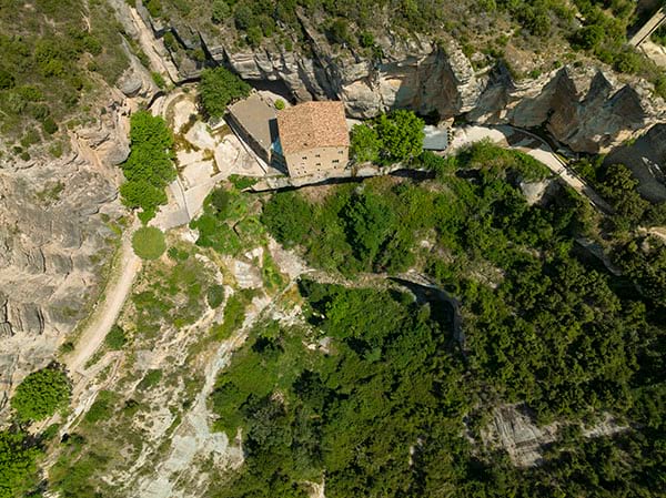
The Sant Miquel del Fai estate is fully included in the Cingles de Bertí Area as part of the Plan of Areas of Natural Interest of Catalonia (PEIN) (Decree 328/1992). This listing endows it with a basic protection and conservation system to preserve scientific, ecological, landscape, cultural, social, educational and recreational assets.
This regulation is implemented in the Special Plan for the Natural Environment and Landscape of the Cingles de Bertí, approved in 2002.
Sant Miquel del Fai forms part of the Natura 2000 Network, more specifically the Gallifa-Cingles de Bertí Special Conservation Area, within the group of inland mountain areas. The estate is also inventoried as an Area of Geological Interest of Catalonia within the Geozone 350, which highlights the spectacular geology of the place and how easy it is to understand, which gives it great educational value. The caves of Sant Miquel del Fai are regarded as habitats of community interest under Directive 43/92/EEC and Royal Decree 1997/1995.
Natural heritage
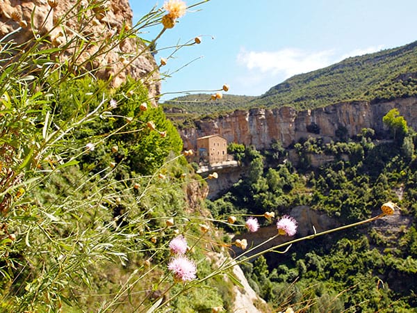
Sant Miquel del Fai is an essential location for Catalan geology due to the unique features to be found there, with cliffs, caves, overhangs, soft limestone, etc.
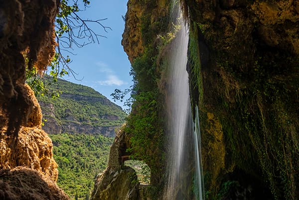
Water (especially the two waterfalls above the Tenes Valley) is one of the most distinctive elements of Sant Miquel del Fai and is largely responsible for its landscape. In this area, there are habitats related to cliffs, caves and riparian forests, with species of particular interest such as Bonelli’s eagle, among many others.
The orographic characteristics of the cliffs have shaped the landscape, particularly the major waterfall of the Tenes river, reachable from inland, which falls from a height of three hundred metres.
The waterfall of the Rossinyol river, a tributary of the Tenes that comes from above the Church of Sant Miquel and fills the central pond, is smaller in size and more difficult to see in action. The best times of the year to enjoy the natural spectacle of the waterfalls are spring and autumn, when the floods bring a greater volume of water to the two rivers.
From an academic standpoint, the area of Sant Miquel del Fai is one of the best studied geological areas in Catalonia. Its walls display rocks and fossils that are up to 570 million years old.
The overhang of the Catalan Pre-Coastal Range that can be seen in Sant Miquel del Fai is a key geological structure in our region which embodies a large part of the history of geology in Catalonia; it’s very easy to reach and has been used for educational purposes for many years.
Des del punt de vista acadèmic, l’àrea de Sant Miquel del Fai és una de les zones geològiques més ben estudiades de Catalunya. Les seves parets mostren roques i fòssils que tenen una antiguitat de fins a 570 milions d’anys.
L’encavalcament de la Serralada Prelitoral que s’observa a Sant Miquel del Fai és una estructura geològica clau del nostre territori que resumeix bona part de la història de la geologia a Catalunya, és d’accés molt fàcil i s’utilitza amb finalitats pedagògiques des de fa molts anys.
Caverns, pools and soft limestone
The Fai area is characterised by spectacular terrain featuring cliffs, caverns, pools and soft limestone.
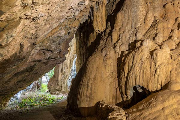
Balmes are natural caverns dug into the rock as a result of the water rushing over the waterfall and slowly eroding the lower wall of the cliff. The balma that houses the church-cave of Sant Miquel is the finest example of this formation.
At the same time as the water erodes the walls, it also excavates the ground it falls on and gives rise to ponds and pools that can be seen at the bottom of the Tenes Valley.
The massif located in Sant Miquel del Fai is calcareous in nature, in other words, it contains calcium carbonate. This facilitates the formation of the soft and slowly formed calcareous, porous and light rocks that are easy to cut, due to the dripping of the water saturated with calcium carbonate onto the plant remains and rock sediments.
We should also highlight the presence of stalactite and stalagmite formations inside the caves, manifestations of the creative capacity of the underground water over the centuries.
Habitats
Nature is plentiful in Sant Miquel del Fai, with an extremely high degree of biodiversity; there are 38 habitats in a region covering just 70 hectares.
The cliff and rupicolous systems (those that live in the rocks) are characteristic of Sant Miquel del Fai, with flora that have adapted to living in small crevices, such as the giant fennel (Ferula communis subespècie catalaunica) and the starthistle (Centaurea intybacea).
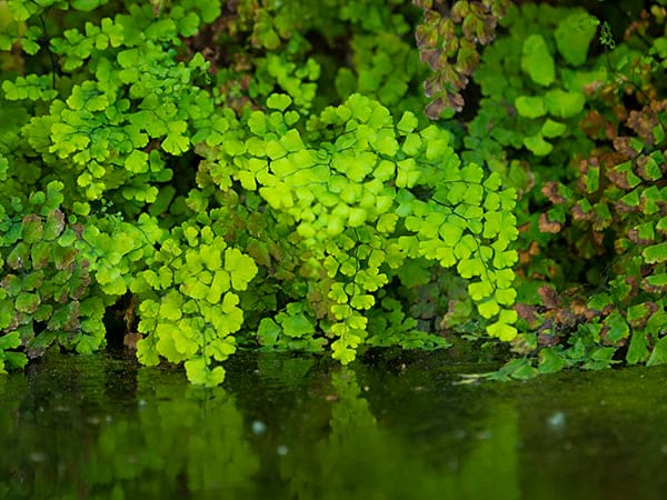
Also noteworthy are the calcareous drips and beds of rushes (typical of waterfalls) and the riparian ecosystems in the Tenes river valley, which contain a wide range of mosses and hygrophilous flora that cannot to be found anywhere else in the Besòs basin.
The cave ecosystems are also characteristic of Sant Miquel del Fai. The particular conditions here - a lack of light, a constant temperature and high levels of humidity - give rise to unique fauna characterised by invertebrates (insects, arachnids, etc.) and bats.
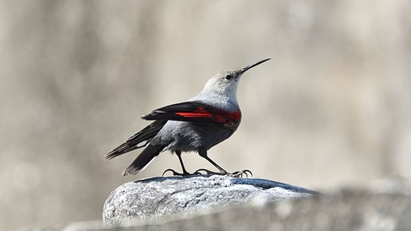
Bonelli’s eagle (Aquila fasciata), a protected bird of prey, currently nests in this area. Other interesting bird species have been identified here, including the white-throated dipper and the wallcreeper.
Forest fires have been a major factor in the development of the natural systems located in the Cingles del Bertí. Although the area has suffered damage throughout its history, the great forest fire of 4th July 1994 that burnt 1,415 hectares of land and affected 88% of the surface area caused the most devastation. Its intensity was so great that 81% of the affected area was completely burnt.


